Green Ways of Brittany (Voies Vertes)
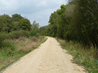
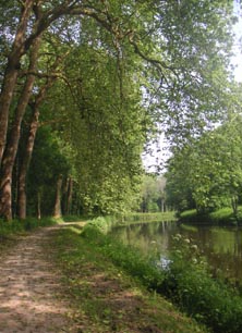
 Brittany has many hundreds of kilometres of Green Ways available for walking, cycling and horse-riding. Most of these routes are former railway lines, now surfaced and waymarked for slower forms of movement. Whilst these do not always provide great views, often being enclosed by trees or banks, they do present a means of travelling extensively in Brittany without walking along main roads. The Green Ways also make for easy and relaxing exercise without much in the way of sharp changes of gradient. In addition, canal tow-paths form key linking stages of these routes, giving remarkably good coverage of varied areas, and passing near to many sites of historical or natural interest. New sections to broaden the jigsaw puzzle of green ways are constantly in progress.
If you are looking for a not-too-challenging walk or simply some good solid exercise, these paths are a great resource. Many signed circular walks leave and return to the main route so that you can incorporate a few surprises and ups-and-downs in a generally easy-going day of walking.
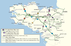
The main central axis from Carhaix to Saint-Méen-le-Grand (126kms) provides a good variety of scenery and places of interest, such as the Abbey of Bon Repos and Lac de Guerlédan with all its leisure facilities, in the heart of Brittany.
 In the west, the Morlaix to Rosporden (101kms) route (north-south) passes near Huelgoat with its famous granite Chaos, through Carhaix and after a brief flirtation with Morbihan via Gourin, reaches the southern parts of Finistere. For a less well-known option, there is also an old railway track linking the fabulous city of Quimper and a lively port at Douarnenez. At 18kms this is suitable for a day out with a bus or taxi to return.
In the east, the 105km route north-south from St-Malo to Rennes passes through the historic town of Dinan with its well-preserved medieval centre and some beautiful stretches of canal near Héde. Once a central section is completed a diversion from this route will make it possible to go on all the way to the Gulf of Morbihan via Ploërmel and Questembert.
For the Nantes-Brest canal, which runs right across Brittany, see separate article in this section of the site.
 Planning a journey (click map to enlarge)
A Red Dog guidebook 'Brittany's Green Ways' is now available, with maps of the major part of the current network of Green Way routes, showing how Green Ways integrate with the roads and logging the facilities in place. The guide also shows liaisons with other leisure routes for walkers and cyclists, points out places of interest nearby and provides a directory of overnight accommodation. For more information including online ordering facility click here
©Wendy Mewes / brittanywalks.com